
Free delivery route planner: use Google Maps
 Luiz Felipe 5 min read

Do you already know all the ways to plan deliveries in your transport operation?
As technology has advanced, various routing tools have emerged in recent years. Although most are comprehensive and efficient, they all also have paid plans.
Google Maps is already a widely used alternative in personal daily life, but it is also valuable for fleets that need to save on their budget. After all, it provides comprehensive information free of charge for general use and helps visualize routes, estimated times and stops.
You can plot a route with important information provided instantly, such as traffic conditions at departure. Besides minimizing travel time through smart routes, this can help reduce spending when the operation does not yet require a specialized solution.
In this post, see:
- How do you plan delivery routes with Google Maps?
- What other types of routing are there?
- How does delivery routing affect operations?
How do you plan delivery routes with Google Maps?
Delivery routing in Google Maps starts with map and route features to organize the path between operational locations.
In other words, the tool helps visualize the route between chosen points, but route quality also depends on information entered by the delivery planner.
For everyday Google Maps users, the most important thing is to check three points before leaving:
- Start and destination: enter the route's departure and arrival points;
- Travel mode: choose the mode closest to the vehicle used for delivery;
- Stops: add intermediate points in the sequence you intend to serve them.
Here are the steps for planning delivery routes with Google Maps:
Step 1 – Define the start and destination
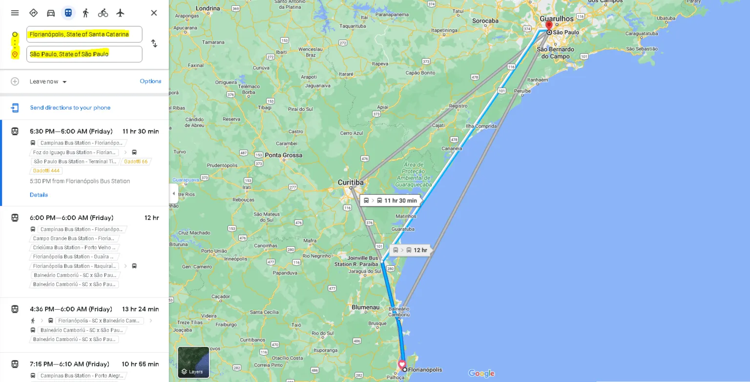
Select the route you want to take.
When you open the mobile app or the map in a desktop browser, the screen already shows a map and search box.
The first step is to enter the start and destination. If your device has permission to access location, the starting location will very likely be filled in automatically. In that case, you can search for the arrival point to also change where the vehicle needs to depart from.
Step 2 – Select the travel mode
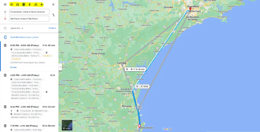
Google Maps offers various features, including travel modes, with routes for cars, motorcycles, trains, walking, bicycles and planes, depending on what is available in the interface.
This stage requires close attention, because routes vary with the travel mode used.
This may happen because some roads do not allow heavy vehicles, for example. Or the loading and unloading (in Portuguese) entrance differs from the entrance for ordinary vehicles, requiring a different route.
There may be various other reasons, so always check the selected vehicle for each route and compare whether the suggested path makes sense for the planned delivery type.
Step 3 – Add stops
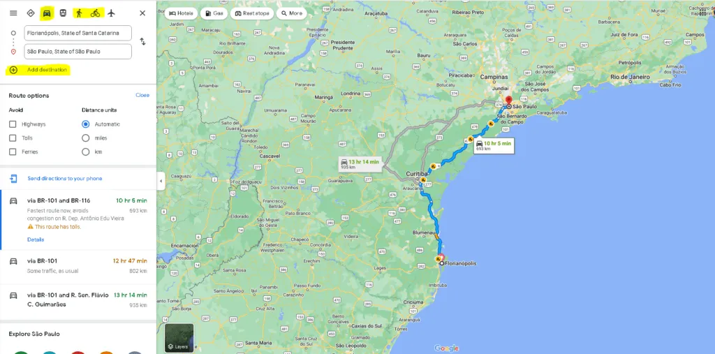
Choose the route's stops.
When planning a delivery, it is usual to consider not only the distance to the endpoint but also time optimization during the operation.
You can create routes with intermediate points representing collections, deliveries or visits along the way. Use the option to add a destination or stop in the interface and organize the locations before starting the route.
However, to plan delivery routes with maximum accuracy and economy, remember:
Although the intelligence behind Google's map can calculate routes including your stops, it works in the order in which you enter those stops.
You should therefore enter the required stops in the order you consider most suitable so the tool can calculate the path within that sequence.
Note: before using Google Maps as a delivery route planner, test whether the number of stops, vehicle type and travel mode selected meet your operational needs. On larger routes, it may be necessary to divide the working day into more than one route or consider a dedicated system.
What other types of delivery routing are there?
Artificial intelligence routing
Artificial intelligence is a logistics trend already used in various parts of transport operations. In delivery routing it is still little known, but the promise is considerable:
You can find systems that create an initial route. They then keep track of the vehicle along the route, learning details about stops made, travel speed and so on.
With each route traveled, this type of system can optimize other routes on its own, provided the data used is consistent and the operation has well-defined rules.
Routing through dedicated systems
Besides a system as advanced as artificial intelligence, there are other technology models offering simpler but still efficient routing.
These plan routes considering all important factors for safety and economy, such as peak times, road conditions, traffic conditions, distance to cover and so on.
A system's advantage over a free tool such as Google Maps is the ability to save your routes and always have them available.
Some software models also offer simultaneous vehicle monitoring through GPS or telemetry — an advantage for those wanting more complete management.
Static routing
This means routing does not change after vehicles have left for deliveries. In static routing, planning happens beforehand to reduce the chances of unexpected events during the trip.
The driver therefore follows the route as a kind of delivery “guide,” always respecting stop criteria, desired mileage and specified times.
Dynamic routing
Dynamic routing is designed precisely to handle what was not in the route plan. It is not fixed planning — on the contrary, it can change even after vehicles are already on the road.
This is the case with companies using routing systems capable of tracking trucks in real time, cross-referencing data with other information, such as GPS.
How does delivery routing affect operations?
Routing is essential for organizing transport operations, allowing a logical, economical delivery sequence.
Regardless of how routes are created, the benefits will be the same:
- Lower logistics costs;
- Better compliance with delivery deadlines;
- Greater driver productivity.
In general, by adopting Google Maps, you are likely to see an increase in production volume (and sales) without having to raise investment and fixed costs for transporting those goods by adopting a routing solution.
It is worth weighing both sides to understand whether this tool alone meets your current needs or whether it is time to take the next step: acquiring a more advanced routing solution for your fleet.
Keep reading about other aspects of fleet management to generate savings and productivity in your operation (in Portuguese) — the material is free, just like Google Maps.
Frequently asked questions
How do you plan delivery routes for free with Google Maps?
How many stops does Google Maps accept on a route?
Does Google Maps organize stops in the best order?
What other types of delivery routing are there?
Is it worth replacing Google Maps with a paid system?
What benefits does routing bring to operations?
// newsletter
Fleet management content, straight to your inbox
Articles on tires, maintenance and fleet operations. No spam.


